M2.9 earthquake Alaska Peninsula
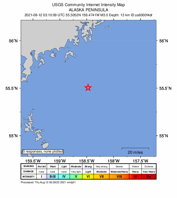
A magnitude 2.9 earthquake struck in the Alaska Peninsula on Wed, Aug 11, 2021, 7:10 PM AKDT (03:10 UTC), 16 km (10 mi) below the surface.
A larger quake followed: M3.3 144 km SSE of Chignik, Alaska. This one was a foreshock.
Map
Where this earthquake was located, with the others nearby. Select one for its page.
The earthquake
- Magnitude
- 2.9 (ml), micro
- Local time
- UTC
- 2021-08-12 03:10:11 UTC
- Depth
- 15.9 km (9.9 mi), shallow
- Epicenter
- 55.524° N, 158.444° W
- Region
- Alaska
- Tsunami flag
- No
- Status
- Reviewed by a seismologist
Did you feel it?
No one has reported feeling this quake to the USGS.
How well it is located
Reviewed by a seismologist.
- Stations used
- 40
Nearest places
Distance and direction from each place to the epicenter, with its forecast.
Nearby
Within 100 km, magnitude 1.5 and up: 200 in the 60 days after this one and 0 in the 30 days before it.
After
- 1.797 km SE of Chignik, Alaska · 1864 days ago · 7 km deep · 73 km away
- 3.3144 km SSE of Chignik, Alaska · 1864 days ago · 9 km deep · 91 km away
- 4.2128 km SSE of Chignik, Alaska · 1864 days ago · 33 km deep · 69 km away
- 2.291 km SSE of Perryville, Alaska · 1864 days ago · 20 km deep · 53 km away
- 2.6158 km SE of Perryville, Alaska · 1864 days ago · 43 km deep · 97 km away
- 2.2101 km SSE of Perryville, Alaska · 1864 days ago · 24 km deep · 48 km away
- 2.055 km SE of Perryville, Alaska · 1863 days ago · 3 km deep · 8 km away
- 2.467 km SE of Perryville, Alaska · 1863 days ago · 25 km deep · 7 km away
- 3.0140 km SE of Perryville, Alaska · 1863 days ago · 26 km deep · 78 km away
- 3.0106 km SE of Perryville, Alaska · 1863 days ago · 12 km deep · 46 km away
- 2.5152 km SE of Perryville, Alaska · 1863 days ago · 23 km deep · 91 km away
- 2.266 km SE of Perryville, Alaska · 1863 days ago · 15 km deep · 5 km away
- 2.665 km S of Ivanof Bay, Alaska · 1863 days ago · 33 km deep · 67 km away
- 3.0138 km SE of Perryville, Alaska · 1863 days ago · 5 km deep · 76 km away
- 2.8145 km SE of Perryville, Alaska · 1863 days ago · 21 km deep · 84 km away
- 2.7129 km SE of Chignik, Alaska · 1862 days ago · 13 km deep · 96 km away
- 1.9118 km SE of Chignik, Alaska · 1862 days ago · 18 km deep · 95 km away
- 2.1129 km SSE of Perryville, Alaska · 1862 days ago · 25 km deep · 70 km away
- 2.1134 km SE of Perryville, Alaska · 1862 days ago · 55 km deep · 73 km away
- 2.5125 km SE of Perryville, Alaska · 1862 days ago · 33 km deep · 64 km away
- 2.8113 km SSE of Perryville, Alaska · 1862 days ago · 10 km deep · 59 km away
- 2.661 km SE of Perryville, Alaska · 1862 days ago · 10 km deep · 2 km away
- 1.775 km ESE of Sand Point, Alaska · 1862 days ago · 6 km deep · 85 km away
- 1.8100 km SSE of Chignik, Alaska · 1861 days ago · 20 km deep · 58 km away
- 2.3120 km SSE of Perryville, Alaska · 1861 days ago · 27 km deep · 61 km away
- 1.574 km S of Perryville, Alaska · 1861 days ago · 20 km deep · 52 km away
- 2.0132 km SE of Perryville, Alaska · 1860 days ago · 24 km deep · 72 km away
- 2.466 km SE of Perryville, Alaska · 1860 days ago · 14 km deep · 6 km away
- 3.4156 km SSE of Chignik, Alaska · 1860 days ago · 13 km deep · 98 km away
- 1.869 km SE of Perryville, Alaska · 1860 days ago · 25 km deep · 10 km away
- 3.7150 km SSE of Chignik, Alaska · 1859 days ago · 7 km deep · 91 km away
- 1.876 km ESE of Sand Point, Alaska · 1859 days ago · 7 km deep · 81 km away
- 1.878 km ESE of Sand Point, Alaska · 1859 days ago · 11 km deep · 74 km away
- 1.857 km ESE of Sand Point, Alaska · 1859 days ago · 42 km deep · 82 km away
- 2.193 km SSE of Perryville, Alaska · 1859 days ago · 30 km deep · 40 km away
- 2.5110 km SSE of Perryville, Alaska · 1859 days ago · 15 km deep · 57 km away
- 2.436 km SSE of Chignik, Alaska · 1858 days ago · 74 km deep · 54 km away
- 3.0136 km SE of Perryville, Alaska · 1858 days ago · 25 km deep · 75 km away
- 2.118 km ESE of Perryville, Alaska · 1858 days ago · 65 km deep · 44 km away
- 2.280 km SSE of Perryville, Alaska · 1858 days ago · 25 km deep · 32 km away
- 2.4156 km SSE of Chignik, Alaska · 1858 days ago · 30 km deep · 97 km away
- 2.0112 km SSE of Perryville, Alaska · 1857 days ago · 38 km deep · 55 km away
- 2.4133 km SE of Perryville, Alaska · 1857 days ago · 40 km deep · 72 km away
- 2.867 km SSE of Perryville, Alaska · 1857 days ago · 15 km deep · 18 km away
- 2.068 km ESE of Sand Point, Alaska · 1857 days ago · 6 km deep · 80 km away
- 1.972 km ESE of Sand Point, Alaska · 1856 days ago · 7 km deep · 85 km away
- 2.036 km SE of Chignik, Alaska · 1856 days ago · 46 km deep · 61 km away
- 1.872 km ESE of Sand Point, Alaska · 1856 days ago · 8 km deep · 83 km away
- 2.073 km ESE of Sand Point, Alaska · 1856 days ago · 9 km deep · 87 km away
- 1.872 km ESE of Sand Point, Alaska · 1856 days ago · 7 km deep · 82 km away
- 1.673 km ESE of Sand Point, Alaska · 1856 days ago · 8 km deep · 84 km away
- 2.4131 km SE of Chignik, Alaska · 1856 days ago · 34 km deep · 85 km away
- 1.773 km ESE of Sand Point, Alaska · 1856 days ago · 8 km deep · 86 km away
- 1.872 km ESE of Sand Point, Alaska · 1856 days ago · 6 km deep · 84 km away
- 1.871 km ESE of Sand Point, Alaska · 1856 days ago · 7 km deep · 79 km away
- 2.274 km ESE of Sand Point, Alaska · 1856 days ago · 7 km deep · 81 km away
- 3.0137 km SE of Perryville, Alaska · 1856 days ago · 18 km deep · 76 km away
- 4.564 km SE of Perryville, Alaska · 1856 days ago · 7 km deep · 6 km away · felt by 2
- 1.893 km SSE of Perryville, Alaska · 1856 days ago · 25 km deep · 41 km away
- 2.5130 km SE of Perryville, Alaska · 1855 days ago · 25 km deep · 69 km away
The first 60 of 200.
Earthquakes todayAlaska earthquakesLive radar here
Sources
From the USGS Earthquake Hazards Program and its partner networks, event ak021aai87d1 (also filed as us6000f4dr). Read Wed, Sep 23, 2026, 3:09 PM UTC.