M5.5 earthquake 276 km ESE of Chiniak, Alaska
A magnitude 5.5 earthquake struck 276 km ESE of Chiniak, Alaska on Tue, May 8, 2018, 12:14 AM AKDT (08:14 UTC), 6 km (4 mi) below the surface.
Map
Where this earthquake was located, with the others nearby. Select one for its page.
The earthquake
- Magnitude
- 5.5 (mww), moderate
- Local time
- UTC
- 2018-05-08 08:14:11 UTC
- Depth
- 6.0 km (3.7 mi), shallow
- Epicenter
- 56.296° N, 148.431° W
- Region
- Alaska
- Felt reports
- 2
- Strongest shaking
- II, weak shaking
- PAGER alert
- Green
- Tsunami flag
- Yes: a large quake in an oceanic region
- Status
- Reviewed by a seismologist
Tsunami
The USGS flags a quake this large in an oceanic region. The flag does not mean a tsunami happened; the tsunami warning centers decide that, and their messages are below when they issued any.
Current tsunami warnings: tsunami.gov. Warnings in force in the US also appear on our alerts pages.
Shaking
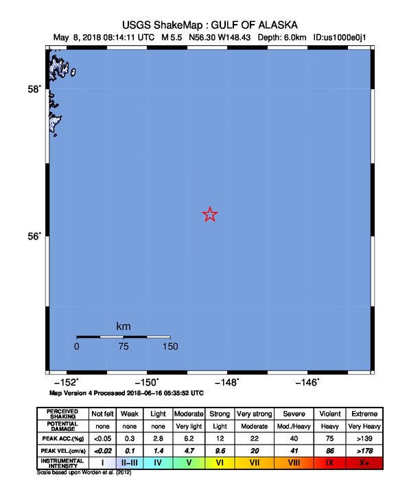
The USGS ShakeMap: shaking estimated from seismic stations and the quake’s size, on the Modified Mercalli intensity scale.
- Strongest estimated
- II, weak shaking
- Peak ground acceleration
- 11.0% of gravity
- Peak ground velocity
- 0.1 cm/s
- Map
- Automatic
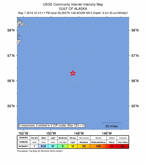
Did you feel it?
2 people reported to the USGS what they felt; the strongest reported shaking was II, weak shaking.
Estimated impact
The USGS PAGER system estimates deaths and economic losses from the shaking and the population and buildings exposed to it.
- Alert level
- Green: little or no damage or loss of life expected
| Range | Chance |
|---|---|
| Under 1 | 69% |
| 1 to 10 | 29% |
| 10 to 100 | 2% |
| 100 to 1,000 | Under 1% |
| 1,000 to 10,000 | Under 1% |
| 10,000 to 100,000 | Under 1% |
| 100,000 to 10,000,000 | Under 1% |
| Range, million USD | Chance |
|---|---|
| Under 1 | 65% |
| 1 to 10 | 30% |
| 10 to 100 | 4% |
| 100 to 1,000 | Under 1% |
| 1,000 to 10,000 | Under 1% |
| 10,000 to 100,000 | Under 1% |
| 100,000 to 10,000,000 | Under 1% |
Fault motion and ground failure
How the rock slipped, from the moment tensor, and the USGS estimate of landslides and liquefaction.
- Faulting
- Strike-slip
- Moment magnitude
- 5.5 Mww
- Nodal plane 1
- Strike 160°, dip 58°, rake 160°
- Nodal plane 2
- Strike 261°, dip 73°, rake 33°
How well it is located
Reviewed by a seismologist.
- Location uncertainty
- About 5.6 km horizontally, 1.8 km in depth
- Magnitude uncertainty
- ±0.04
- Depth from
- From modeling of broad-band P waveforms
- Station coverage gap
- 85°
- Stations used
- 537
Nearest places
Distance and direction from each place to the epicenter, with its forecast.
Nearby
Within 100 km, magnitude 2.5 and up: 200 in the 60 days after this one and 0 in the 30 days before it.
After
- 2.5221 km SE of Chiniak, Alaska · 3035 days ago · 21 km deep · 77 km away
- 3.0249 km ESE of Chiniak, Alaska · 3035 days ago · 20 km deep · 29 km away
- 3.2Gulf of Alaska · 3035 days ago · 22 km deep · 19 km away
- 3.1255 km ESE of Chiniak, Alaska · 3035 days ago · 22 km deep · 25 km away
- 2.9269 km ESE of Chiniak, Alaska · 3035 days ago · 10 km deep · 12 km away
- 2.8274 km ESE of Chiniak, Alaska · 3035 days ago · 10 km deep · 19 km away
- 2.7274 km ESE of Chiniak, Alaska · 3035 days ago · 18 km deep · 62 km away
- 3.0262 km SE of Chiniak, Alaska · 3035 days ago · 9 km deep · 73 km away
- 2.5252 km ESE of Chiniak, Alaska · 3035 days ago · 23 km deep · 48 km away
- 3.2289 km ESE of Chiniak, Alaska · 3035 days ago · 20 km deep · 24 km away
- 2.9245 km SE of Chiniak, Alaska · 3035 days ago · 20 km deep · 58 km away
- 2.9257 km ESE of Chiniak, Alaska · 3034 days ago · 21 km deep · 19 km away
- 2.7275 km SE of Chiniak, Alaska · 3034 days ago · 12 km deep · 71 km away
- 3.2262 km SE of Chiniak, Alaska · 3034 days ago · 11 km deep · 69 km away
- 2.9247 km ESE of Chiniak, Alaska · 3034 days ago · 21 km deep · 40 km away
- 3.4253 km ESE of Chiniak, Alaska · 3034 days ago · 21 km deep · 27 km away
- 3.2250 km ESE of Chiniak, Alaska · 3034 days ago · 22 km deep · 31 km away
- 2.8253 km ESE of Chiniak, Alaska · 3034 days ago · 20 km deep · 31 km away
- 3.1248 km ESE of Chiniak, Alaska · 3034 days ago · 21 km deep · 33 km away
- 3.0219 km SE of Chiniak, Alaska · 3033 days ago · 22 km deep · 91 km away
- 3.0221 km SE of Chiniak, Alaska · 3033 days ago · 20 km deep · 92 km away
- 3.4276 km SE of Chiniak, Alaska · 3033 days ago · 9 km deep · 78 km away
- 2.9238 km SE of Chiniak, Alaska · 3033 days ago · 21 km deep · 85 km away
- 2.9274 km SE of Chiniak, Alaska · 3033 days ago · 8 km deep · 79 km away
- 3.2276 km ESE of Chiniak, Alaska · 3033 days ago · 10 km deep · 16 km away
- 3.4234 km SE of Chiniak, Alaska · 3033 days ago · 23 km deep · 62 km away
- 2.8250 km SE of Chiniak, Alaska · 3033 days ago · 20 km deep · 61 km away
- 2.9235 km SE of Chiniak, Alaska · 3032 days ago · 21 km deep · 81 km away
- 2.8226 km SE of Chiniak, Alaska · 3032 days ago · 21 km deep · 80 km away
- 3.0222 km SE of Chiniak, Alaska · 3032 days ago · 10 km deep · 99 km away
- 3.3211 km SE of Chiniak, Alaska · 3032 days ago · 10 km deep · 93 km away
- 2.6241 km ESE of Chiniak, Alaska · 3032 days ago · 10 km deep · 43 km away
- 3.2281 km SE of Chiniak, Alaska · 3032 days ago · 9 km deep · 76 km away
- 2.9221 km SE of Chiniak, Alaska · 3032 days ago · 22 km deep · 83 km away
- 3.0251 km ESE of Chiniak, Alaska · 3031 days ago · 21 km deep · 28 km away
- 2.8243 km SE of Chiniak, Alaska · 3031 days ago · 20 km deep · 57 km away
- 2.8241 km SE of Chiniak, Alaska · 3031 days ago · 21 km deep · 50 km away
- 2.8219 km SE of Chiniak, Alaska · 3031 days ago · 10 km deep · 92 km away
- 3.2229 km SE of Chiniak, Alaska · 3031 days ago · 22 km deep · 98 km away
- 3.0229 km SE of Chiniak, Alaska · 3031 days ago · 23 km deep · 93 km away
- 2.9245 km SE of Chiniak, Alaska · 3031 days ago · 20 km deep · 57 km away
- 3.2199 km SE of Chiniak, Alaska · 3030 days ago · 22 km deep · 93 km away
- 2.7236 km SE of Chiniak, Alaska · 3030 days ago · 12 km deep · 91 km away
- 2.6240 km SE of Chiniak, Alaska · 3030 days ago · 7 km deep · 95 km away
- 2.7263 km SE of Chiniak, Alaska · 3030 days ago · 21 km deep · 20 km away
- 2.6205 km ESE of Chiniak, Alaska · 3030 days ago · 7 km deep · 74 km away
- 2.9238 km SE of Chiniak, Alaska · 3030 days ago · 9 km deep · 99 km away
- 2.8224 km SE of Chiniak, Alaska · 3030 days ago · 21 km deep · 100 km away
- 2.7229 km SE of Chiniak, Alaska · 3029 days ago · 22 km deep · 59 km away
- 2.6231 km SE of Chiniak, Alaska · 3029 days ago · 10 km deep · 97 km away
- 3.2265 km ESE of Chiniak, Alaska · 3029 days ago · 21 km deep · 13 km away
- 2.8260 km ESE of Chiniak, Alaska · 3029 days ago · 22 km deep · 16 km away
- 3.3279 km SE of Chiniak, Alaska · 3029 days ago · 8 km deep · 52 km away
- 2.9251 km ESE of Chiniak, Alaska · 3029 days ago · 10 km deep · 27 km away
- 2.7241 km SE of Chiniak, Alaska · 3028 days ago · 8 km deep · 94 km away
- 3.2261 km SE of Chiniak, Alaska · 3028 days ago · 9 km deep · 68 km away
- 2.8253 km ESE of Chiniak, Alaska · 3028 days ago · 22 km deep · 25 km away
- 2.5230 km SE of Chiniak, Alaska · 3028 days ago · 21 km deep · 86 km away
- 2.8231 km SE of Chiniak, Alaska · 3028 days ago · 12 km deep · 81 km away
- 2.9228 km SE of Chiniak, Alaska · 3027 days ago · 21 km deep · 53 km away
The first 60 of 200.
Earthquakes todayAlaska earthquakesLive radar here
Sources
From the USGS Earthquake Hazards Program and its partner networks, event us1000e0j1 (also filed as ak0185vtmxcv, ak19362293, at00p8ehjn, iscgem611931579). Read Tue, Sep 22, 2026, 3:57 PM UTC.