M3.9 earthquake 76 km WNW of La Ligua, Chile
A magnitude 3.9 earthquake struck 76 km WNW of La Ligua, Chile on Mon, Feb 8, 2016, 8:45 PM GMT-3 (23:45 UTC), 24 km (15 mi) below the surface.
A larger quake followed: M4.3 16 km SW of Illapel, Chile. This one was a foreshock.
Map
Where this earthquake was located, with the others nearby. Select one for its page.
The earthquake
- Magnitude
- 3.9 (mwr), minor
- Local time
- UTC
- 2016-02-08 23:45:59 UTC
- Depth
- 23.7 km (14.7 mi), shallow
- Epicenter
- 32.113° S, 71.939° W
- Region
- Chile
- Tsunami flag
- No
- Status
- Reviewed by a seismologist
Did you feel it?
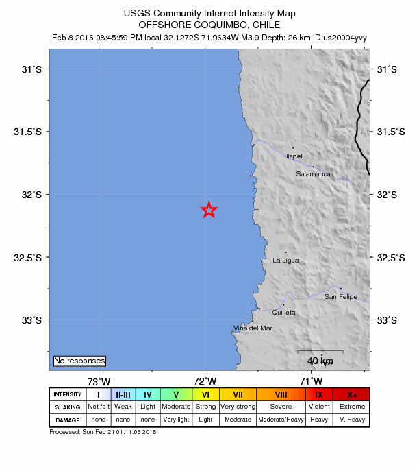
No one has reported feeling this quake to the USGS.
Fault motion and ground failure
How the rock slipped, from the moment tensor, and the USGS estimate of landslides and liquefaction.
- Faulting
- Reverse (thrust)
- Moment magnitude
- 3.9 Mwr
- Nodal plane 1
- Strike 12°, dip 33°, rake 102°
- Nodal plane 2
- Strike 178°, dip 58°, rake 82°
How well it is located
Reviewed by a seismologist.
- Location uncertainty
- About 4.1 km horizontally, 4.0 km in depth
- Magnitude uncertainty
- ±0.05
- Depth from
- From location
- Station coverage gap
- 190°, poorly surrounded by stations
- Stations used
- 47
Nearest places
Distance and direction from each place to the epicenter, with its forecast.
Nearby
Within 100 km, magnitude 1.5 and up: 18 in the 60 days after this one and 8 in the 30 days before it.
After
- 4.316 km SW of Illapel, Chile · 3875 days ago · 55 km deep · 73 km away
- 4.186 km W of Illapel, Chile · 3865 days ago · 6 km deep · 51 km away
- 3.955 km WNW of Illapel, Chile · 3862 days ago · 22 km deep · 74 km away
- 4.2102 km W of Illapel, Chile · 3858 days ago · 10 km deep · 69 km away
- 4.097 km W of Illapel, Chile · 3857 days ago · 20 km deep · 42 km away
- 4.128 km SW of Illapel, Chile · 3851 days ago · 44 km deep · 62 km away
- 3.947 km WSW of La Ligua, Chile · 3845 days ago · 31 km deep · 60 km away · felt by 1
- 4.659 km WNW of La Ligua, Chile · 3844 days ago · 28 km deep · 19 km away
- 4.358 km WNW of Illapel, Chile · 3843 days ago · 41 km deep · 75 km away
- 5.368 km NW of Illapel, Chile · 3843 days ago · 25 km deep · 99 km away · felt by 11
- 4.477 km NW of Illapel, Chile · 3843 days ago · 25 km deep · 98 km away
- 4.274 km NW of Illapel, Chile · 3842 days ago · 35 km deep · 98 km away
- 4.318 km WSW of Illapel, Chile · 3838 days ago · 52 km deep · 72 km away
- 4.561 km WNW of Illapel, Chile · 3838 days ago · 29 km deep · 75 km away
- 4.627 km WSW of Illapel, Chile · 3836 days ago · 43 km deep · 62 km away · felt by 1
- 4.189 km W of Illapel, Chile · 3832 days ago · 13 km deep · 44 km away
- 5.372 km NW of Illapel, Chile · 3823 days ago · 24 km deep · 99 km away · felt by 4
- 5.360 km WNW of Illapel, Chile · 3821 days ago · 30 km deep · 72 km away · felt by 7
Before
- 4.381 km WNW of La Ligua, Chile · 3879 days ago · 22 km deep · 6 km away
- 4.495 km W of Illapel, Chile · 3881 days ago · 12 km deep · 42 km away
- 4.243 km NNW of Valparaíso, Chile · 3891 days ago · 24 km deep · 63 km away
- 4.853 km NNW of Valparaíso, Chile · 3893 days ago · 8 km deep · 54 km away · felt by 25
- 4.590 km W of Illapel, Chile · 3893 days ago · 15 km deep · 50 km away
- 4.330 km WSW of Salamanca, Chile · 3899 days ago · 75 km deep · 69 km away
- 4.269 km NW of Illapel, Chile · 3902 days ago · 29 km deep · 98 km away
- 5.065 km WNW of Illapel, Chile · 3908 days ago · 26 km deep · 89 km away · felt by 2
Earthquakes todayChile earthquakesLive radar here
Sources
From the USGS Earthquake Hazards Program and its partner networks, event us20004yvy. Read Tue, Sep 22, 2026, 3:33 PM UTC.