M3.9 earthquake 9 km NW of Timpson, Texas
A magnitude 3.9 earthquake struck 9 km NW of Timpson, Texas on Thu, May 10, 2012, 10:15 AM CDT (15:15 UTC), 7 km (4 mi) below the surface.
A larger quake followed: M4.8 3 km NE of Timpson, Texas. This one was a foreshock.
Map
Where this earthquake was located, with the others nearby. Select one for its page.
The earthquake
- Magnitude
- 3.9 (mwr), minor
- Local time
- UTC
- 2012-05-10 15:15:38 UTC
- Depth
- 7.0 km (4.3 mi), shallow
- Epicenter
- 31.964° N, 94.465° W
- Region
- Texas
- Felt reports
- 94
- Tsunami flag
- No
- Status
- Reviewed by a seismologist
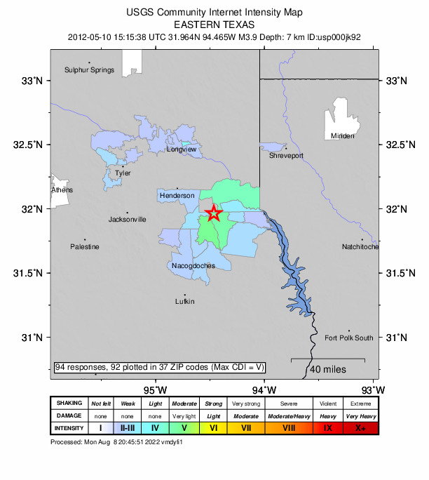
Did you feel it?
94 people reported to the USGS what they felt; the strongest reported shaking was V, moderate shaking.
Fault motion and ground failure
How the rock slipped, from the moment tensor, and the USGS estimate of landslides and liquefaction.
- Faulting
- Oblique reverse
- Nodal plane 1
- Strike 171°, dip 88°, rake 36°
- Nodal plane 2
- Strike 79°, dip 54°, rake 177°
How well it is located
Reviewed by a seismologist.
- Station coverage gap
- 58°
- Stations used
- 122
Nearest places
Distance and direction from each place to the epicenter, with its forecast.
Nearby
Within 100 km, magnitude 1.5 and up: 4 in the 60 days after this one and 0 in the 30 days before it.
After
- 4.83 km NE of Timpson, Texas · 5242 days ago · 5 km deep · 10 km away · felt by 573
- 2.75 km W of Timpson, Texas · 5238 days ago · 5 km deep · 7 km away · felt by 29
- 2.52 km S of Timpson, Texas · 5233 days ago · 5 km deep · 12 km away · felt by 20
- 2.14 km SW of Timpson, Texas · 5212 days ago · 5 km deep · 10 km away
Earthquakes todayTexas earthquakesLive radar here
Sources
From the USGS Earthquake Hazards Program and its partner networks, event usp000jk92 (also filed as usb0009m4g). Read Wed, Sep 23, 2026, 1:50 AM UTC.