M3.8 earthquake 8 km NNE of Aurora, Colorado
A magnitude 3.8 earthquake struck 8 km NNE of Aurora, Colorado on Sat, Nov 20, 1965, 9:02 PM GMT-7 (04:02 UTC), 5 km (3 mi) below the surface.
Map
Where this earthquake was located, with the others nearby. Select one for its page.
The earthquake
- Magnitude
- 3.8 (ml), minor
- Local time
- UTC
- 1965-11-21 04:02:28 UTC
- Depth
- 5.0 km (3.1 mi), shallow
- Epicenter
- 39.800° N, 104.800° W
- Region
- Colorado
- Strongest shaking
- V, moderate shaking
- Tsunami flag
- No
- Status
- Reviewed by a seismologist
Shaking
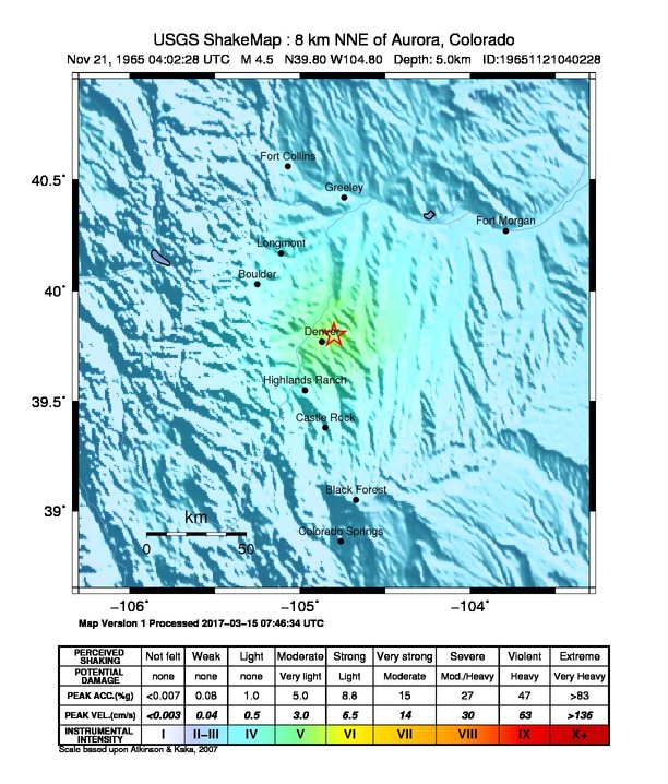
The USGS ShakeMap: shaking estimated from seismic stations and the quake’s size, on the Modified Mercalli intensity scale.
- Strongest estimated
- V, moderate shaking
- Map
- Automatic
Did you feel it?
No one has reported feeling this quake to the USGS.
Nearest places
Distance and direction from each place to the epicenter, with its forecast.
Nearby
Within 100 km, magnitude 1.5 and up: 0 in the 60 days after this one and 0 in the 30 days before it.
None recorded.
Earthquakes todayColorado earthquakesLive radar here
Sources
From the USGS Earthquake Hazards Program and its partner networks, event ushis2864 (also filed as atlas19651121040228). Read Tue, Sep 22, 2026, 7:32 AM UTC.