The Greenfield, Iowa tornado of May 21, 2024
EF4 Page, Taylor, Adams and Adair counties, Iowa · surveyed by NWS Des Moines
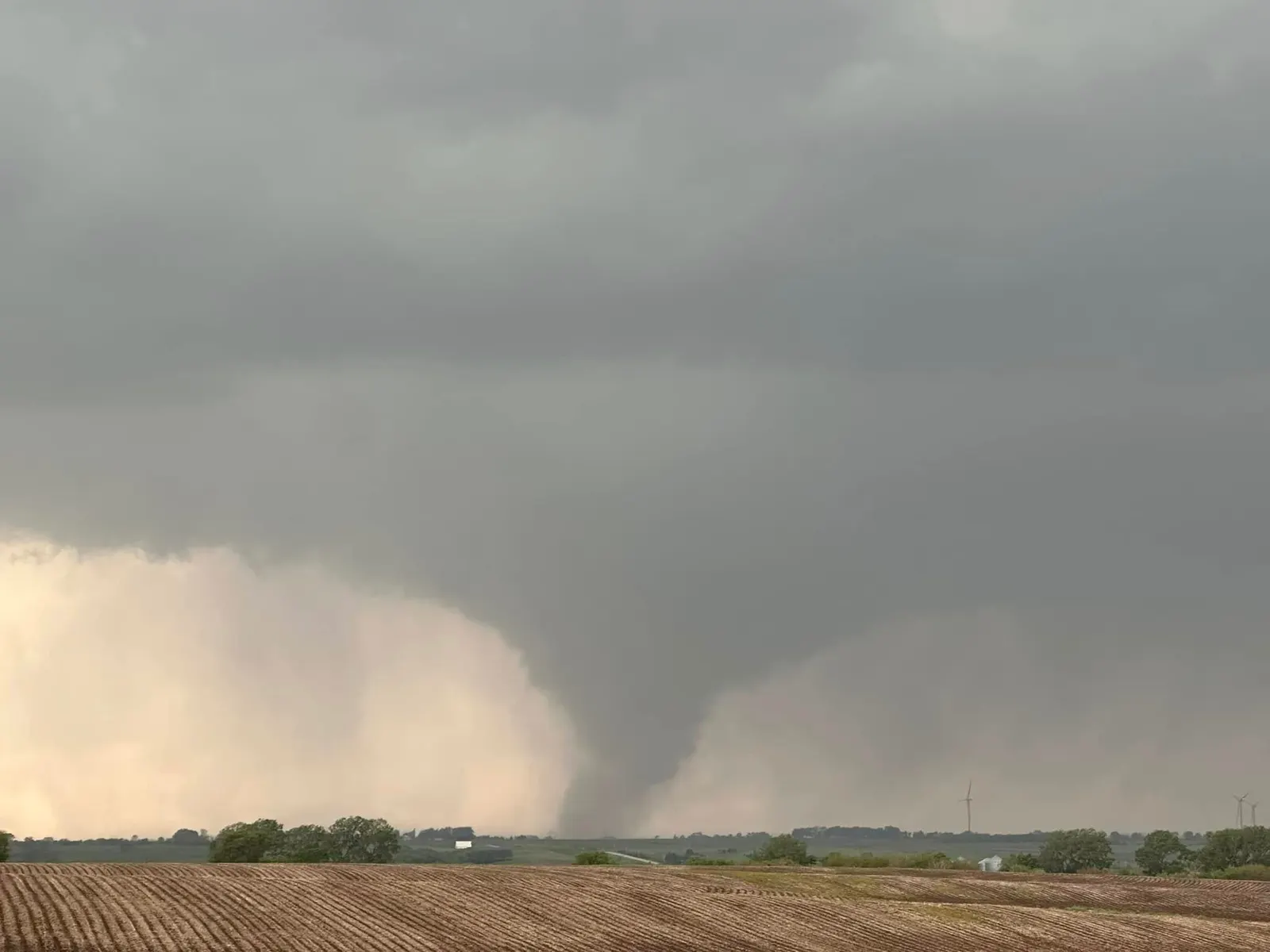
On a moderate-risk afternoon in southwest Iowa, a supercell put down a tornado that ran 42 miles in 46 minutes, felled utility-scale wind turbines, and crossed the town of Greenfield in about a minute. The damage survey rated it EF4. A research radar parked at the edge of town measured winds that only two tornadoes in recorded history are known to have matched. Five people died, and a town of two thousand lost a large share of its housing in under sixty seconds.
- Rating
- EF4 175–185 mph estimated
- Mobile radar winds
- 309–318 mph preliminary, 100–160 ft aloft
- Path length
- 42.38 mi
- Max width
- 1,600 yd about 0.9 mi
- On the ground
- 46 min 2:57–3:43 pm CDT
- Forward speed
- ~45 mph
- Deaths
- 5
- Injuries
- 35+
- Damage
- ~$31M 2024 USD
- Radar
- KDMX Des Moines WSR-88D
- Warning lead
- ~40 min warned 2:55 pm CDT
- Watch
- PDS 277 issued 1:10 pm CDT
The setup
May 21 began in Iowa with water, not wind. A low-pressure system the previous evening had dropped two to four inches of rain, and by morning flash flooding was forcing evacuations and sandbagging in Kellogg and Baxter, with 75 to 100 roads closed across central Iowa.[1] Behind the rain, a cold front was moving into an air mass primed for something worse.
The Storm Prediction Center had the day flagged early. Its 8:00 am (1300 UTC) Day 1 outlook placed much of Iowa under a Moderate risk, level 4 of 5, with a 15 percent hatched tornado probability, the hatching meaning significant tornadoes of EF2 strength or greater were expected within 25 miles of a point. The outlook called for "scattered to numerous thunderstorms (including multiple fast-moving supercells)" and "several tornadoes -- some strong," in an environment of 2,000 to 3,000 J/kg of mixed-layer CAPE and effective storm-relative helicity above 300 m²/s².[3] By the 3:00 pm update the language had hardened: "tornadoes appear imminent across much of IA over the next few hours."[4]
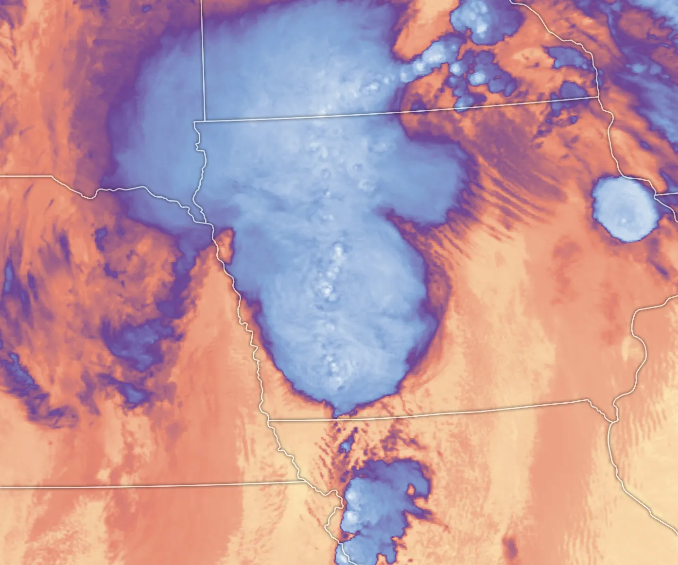
At 1:10 pm CDT the Storm Prediction Center issued Tornado Watch 277 for nearly all of Iowa and adjacent states, and marked it a Particularly Dangerous Situation, wording it reserves for its highest-confidence watches. The watch carried a 90 percent probability of two or more tornadoes and an 80 percent probability of at least one EF2 or stronger, along with "several tornadoes and a few intense tornadoes likely."[5] Nine tornadoes would be surveyed in the Des Moines office's area alone by the end of the day, out of 41 tornado reports nationally.[1][6]
The forecast and the warning
Greenfield's warning did not begin with the warning. At the NOAA Hazardous Weather Testbed, the experimental Warn-on-Forecast system, which runs rapid-cycling computer models and machine learning to project individual storms beyond radar range in time, showed strong probabilities of intense near-ground rotation in the Greenfield area more than an hour before the tornado touched down, and the signal was shared with the forecasters working the event.[8]
The operational warning followed the radar. At 2:55 pm, two minutes before touchdown, NWS Des Moines issued a tornado warning for southwestern Adair and surrounding counties on radar-indicated rotation near Viking Lake State Park, naming Greenfield in its path. At 3:01 pm the warning was upgraded: "a confirmed large and extremely dangerous tornado," with the considerable-damage tag and particularly dangerous situation wording. At 3:27 pm a follow-up statement placed the tornado six miles southwest of Greenfield, expected in town around 3:35 pm.[7] The town had roughly forty minutes from first warning to impact.
-
PDS Tornado Watch 277 issued for nearly all of Iowa, valid to 9:00 pm.[5]
-
Tornado warning issued on radar-indicated rotation, naming Greenfield, Fontanelle and Nodaway Park in its path.[7]
-
Touchdown in rural Page County, about 3.4 miles northeast of Hepburn. Early damage is EF1: tree limbs and farm outbuildings.[1][2][24]
-
Warning upgraded: "confirmed large and extremely dangerous tornado," PDS wording, considerable damage tag.[7]
-
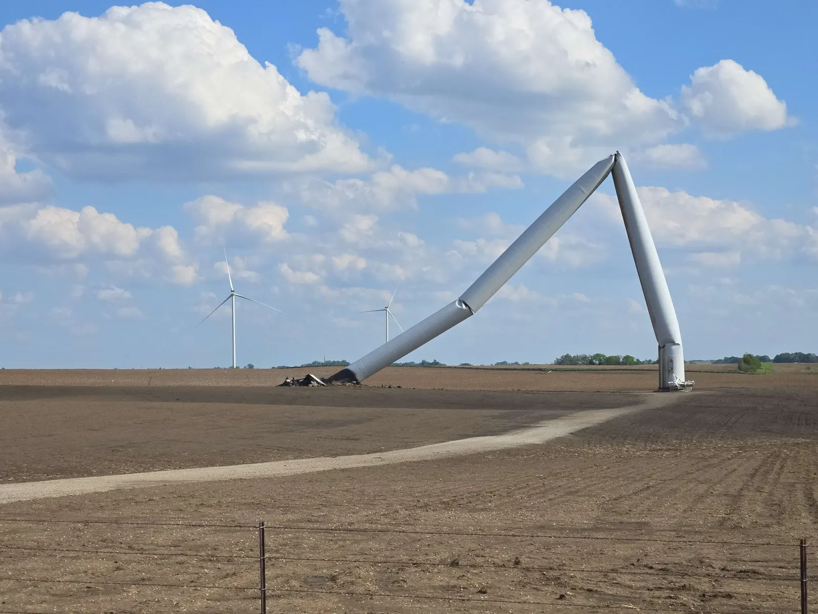
Crossing Adams County at EF2–EF3 strength, briefly clipping Taylor County. The tornado crosses US 34 north of Brooks as a large multi-vortex funnel, kills a driver on Iowa 148, and begins toppling wind turbines, one of which catches fire.[18][24]
-
Southern Adair County. Well-built rural homes are leveled or swept away at EF4 intensity along Fontanelle Road, 310th Street, 290th Street and Jordan Avenue; more turbines go down.[1][24]
-
Warning update: tornado six miles southwest of Greenfield, expected in town around 3:35 pm. "TAKE COVER NOW!"[7]
-
The tornado, narrowing and at peak intensity, crosses Greenfield from southwest to northeast in about a minute. Peak surveyed damage: a well-built home on SE 2nd Street obliterated and swept away, rated at 185 mph.[9][24]
-
As the Greenfield tornado weakens, the same supercell puts down a new EF2 tornado that runs 11.87 miles through northeastern Adair County.[1]
-
Dissipation northeast of Greenfield, 46 minutes and 42.38 miles after touchdown.[1][2]
The track
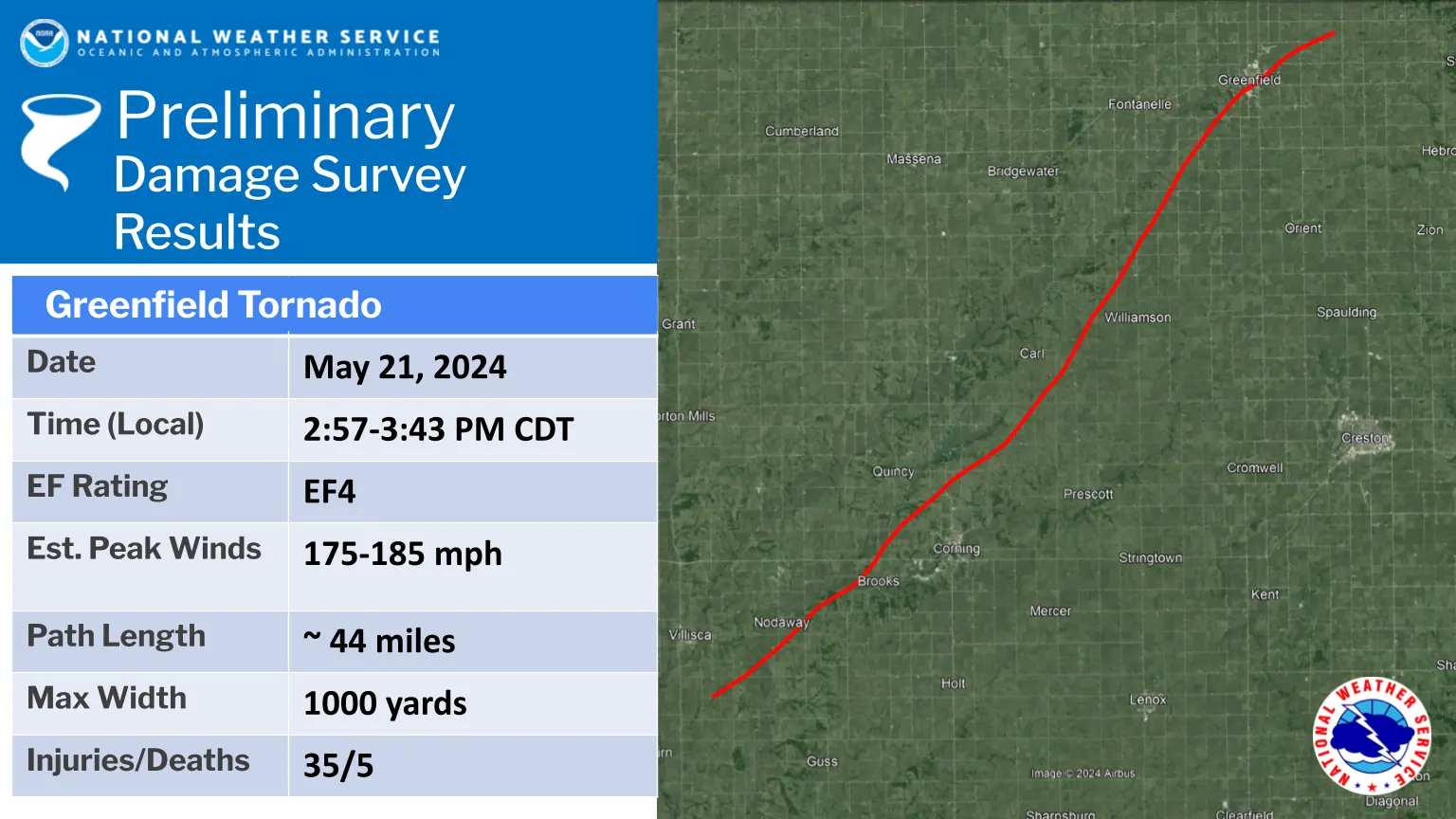
The tornado spent its first minutes unremarkably, doing EF1 damage to trees and outbuildings in rural Page County. It organized quickly in Adams County, where video showed a broad funnel with a debris cloud and multiple vortices beneath it as it crossed US 34 north of Brooks. Near Iowa 148 it caught a vehicle in open country and killed the driver. An unanchored home at 150th Street and Notchwood Avenue lost its walls and slid from its foundation, and the circulation grew to its widest in the county, around 1,300 yards.[24]
In Adams and Adair counties the track ran through operating wind farms, and the tornado became, briefly, the most photographed turbine-killer in the country: several 250-foot turbines at MidAmerican Energy's Orient site were bent to the ground or snapped, and one burned, its blades still turning as the nacelle caught.[18] Southern Adair County took the worst rural damage. Along Fontanelle Road a well-anchored home was destroyed at EF4 intensity with its debris thrown into a field, and three more homes nearby were leveled or swept away.[24]
One minute in Greenfield
Tornadoes usually weaken as they contract. This one did the opposite. Approaching Greenfield it narrowed sharply while intensifying, and it entered the southwest side of town, past the Nodaway Park ponds, at mid-range EF4 strength, moving about 45 mph.[9][24] Residents at the one-year memorial would ring a bell sixty times, once for each second the tornado took to cross the town.[20]
In that minute, dozens of homes were leveled and some partially swept away. The surveyed peak, 185 mph, was assigned at a well-built home on SE 2nd Street that was removed to its foundation. High-end EF3 damage extended through the southeast side of town and low-end EF4 damage to the east side near the junction of Iowa highways 92 and 25. The Adair County Memorial Hospital, the county's only hospital, was critically damaged and evacuated, its patients transferred to other facilities.[17][24]
"I could hear this roaring, like the proverbial freight train, and then it was just done."
Mary Long, owner of Long's Market, Greenfield, to the Associated Press[17]
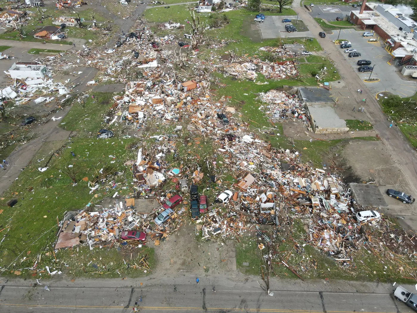
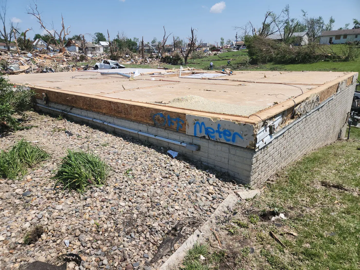
Counts of the destruction vary with the definition. Iowa Public Radio reported more than 150 homes destroyed; Radio Iowa put homes destroyed or heavily damaged above 200, along with about 30 businesses, in a town of roughly 2,000 people.[20][21] NOAA's damage estimate for the tornado is about $31 million.[21][24]
The radar record
The Des Moines WSR-88D, KDMX, sits 55 miles northeast of Greenfield, close enough that its lowest beam sampled the storm well. The full Level II record of the day is in the archive here, and the three signatures below can be stepped through scan by scan. All three frames are from the 0.5° tilt in the minutes around the strike on the town.
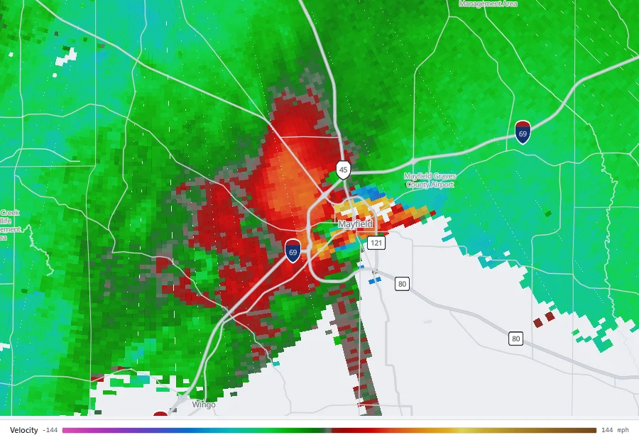
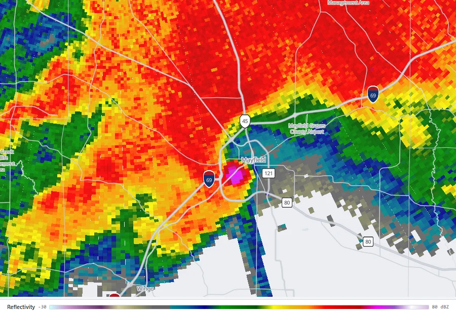
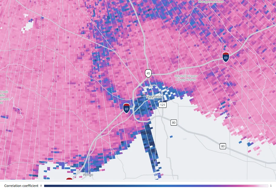
Replay the strike on Greenfield: reflectivity, velocity and correlation coefficient side by side on KDMX, starting minutes before the tornado entered town.
Open in the archiveOr start at touchdown, 2:57 pm in Page County, and follow all 46 minutes scan by scan as the circulation tightens.
Open at touchdownThe wind measurement
What separates Greenfield from nearly every other violent tornado is that a research radar was waiting for it. A team of nine scientists led by Karen Kosiba and Joshua Wurman of the FARM Facility (Flexible Array of Radars and Mesonets), operating under the National Science Foundation's BEST project on tornado boundary-layer winds, deployed a Doppler on Wheels just east of Greenfield, ultimately about 300 yards from the tornado's path, scanning every seven seconds as the tornado crossed the town.[10][13]
Doppler radar has recorded winds above 300 mph in only two other tornadoes: Bridge Creek, Oklahoma on May 3, 1999, originally reported at 302 mph and revised to 321 mph in a 2021 reanalysis, and El Reno, Oklahoma on May 31, 2013, with 291 to 336 mph in small sub-vortices. The FARM team's assessment placed Greenfield in that company: "among the highest wind speeds ever determined using DOW data."[9] The measurement was also unusually close to a populated place. "Measuring low-level winds very close to a town is very rare," Kosiba said. "It's a rich and unusual dataset."[10]
Why it stayed an EF4
The official rating did not change, and the reasons are structural to how tornadoes are rated. The EF scale rates what a tornado does to structures, not what instruments measure; the radar's winds were measured 100 to 160 feet up, well above the 3-meter height damage indicators represent; the beam tracks debris, which lags the air carrying it; and the peak gust lasted under a second at any point, where damage reflects a longer battering. The survey's own ceiling, 185 mph at a swept-clean home site, is what the wreckage itself could testify to. Kosiba's summary was blunt: it is possible nothing in the path could have sustained damage that only an EF5 could produce.[9][10]
The disagreement fed a public debate about the EF scale itself. Iowa State meteorology professor Bill Gallus noted radar measurements are taken too inconsistently to fold into ratings, and NWS Des Moines' Chad Hahn said the surveyed damage did not support a rating matching the radar estimate. Pieter Groenemeijer, director of the European Severe Storms Laboratory, observed that on Europe's IF scale the same measurement would rate IF5. Wurman and Kosiba's 2025 reanalysis quantified the gap: peak radar-determined winds along the track ran about 20 percent stronger than damage-inferred winds, each method carrying error bars of roughly the same size.[11][24]
What the dataset is teaching
The Greenfield data has kept producing findings. Matching measured winds against turbine outcomes gave engineering a rare calibrated threshold: every turbine that experienced at least 154 mph toppled, every one under about 145 mph survived, and at least one was destroyed well outside the visible funnel.[11] The team also collected linear depolarization measurements of the debris cloud, extreme values that may become a signature operational radars can use to gauge a tornado's violence by what it is lofting. A dedicated paper was in review at the Bulletin of the American Meteorological Society as of May 2026.[12]
"This Greenfield tornado, one mile difference in track would have meant it never went through the town."
Joshua Wurman, FARM Facility[12]
The scar from space
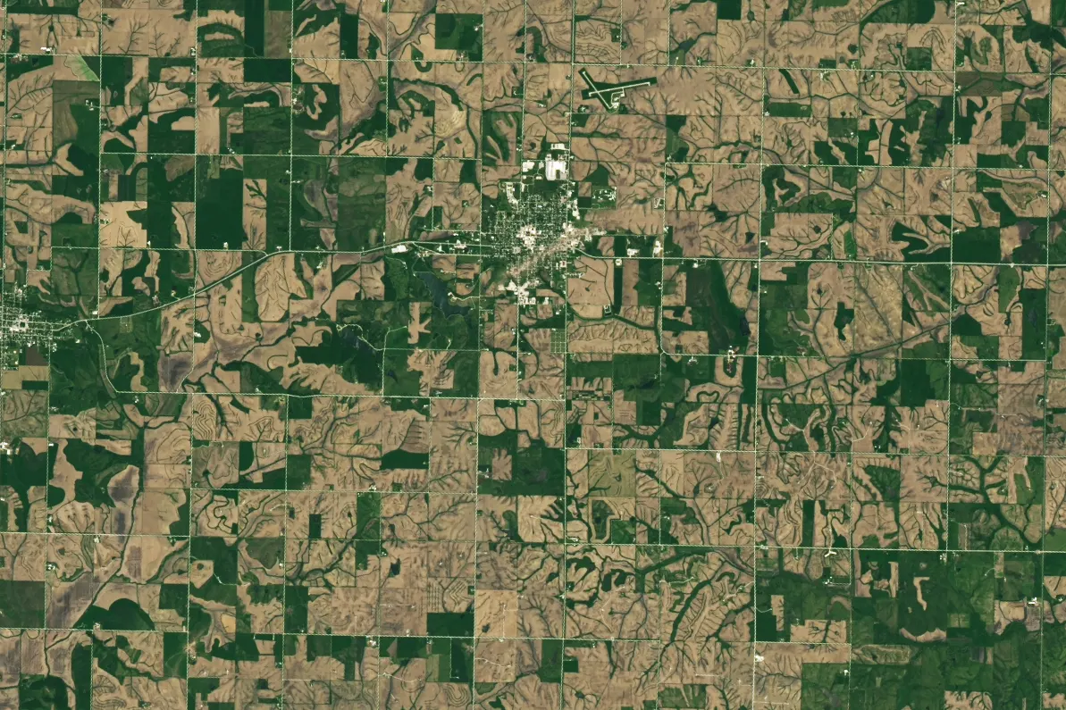
NASA's Earth Observatory published the image the following week: a 40-plus mile abrasion in the landscape, visible from 438 miles up, cut by scoured vegetation, stripped soil and debris. The scar crosses roads, farmsteads and the town itself, and it remained visible in satellite imagery well into the growing season.[14]
The victims
Five people were killed, all adults, one on the road and four in their homes.[16]
- Monica Irma Zamarron, 49, of Shenandoah, caught in her vehicle on Iowa 148 near Corning in Adams County.
- William Williamson, 70, taken from his home in Greenfield; he died at a hospital.
- Michael Jensen, 73, at his home on SE Jackson Street, Greenfield.
- Pamela Wiggins, 77, at her home on Iowa Street, Greenfield.
- Dean Wiggins, 78, her husband, at the same home.
At least 35 people were injured, a figure the state's joint command cautioned was a floor rather than a count, since it reflected only patients treated at designated alternate care sites after the hospital itself was knocked out.[15][16] Fourteen were transported to hospitals outside the county.[15] Among the survivors, Sheri Wolf, her son and her mother were pulled from the air as their home disintegrated; Wolf came to rest two houses away. "We shouldn't have lived, but we did," she told Iowa Public Radio a year later.[20]
Aftermath and recovery
Response began before the debris settled, with storm chasers and neighbors joining first responders in the search; a man was pulled from rubble that evening. The Iowa State Patrol closed the town behind checkpoints under a one-day curfew while crews confirmed every resident was accounted for.[17][18][24] Governor Kim Reynolds toured the town on May 22 and called the damage gut-wrenching; on May 24, three days after the tornado, President Biden approved an expedited major disaster declaration covering Adair and three other counties, activating FEMA individual assistance and public assistance.[18][19]
Money moved fast and from unusual directions. The Y'all Squad, the nonprofit founded by weather streamer Ryan Hall, arrived within hours, and his audience raised $93,000 for recovery the same night.[24] The Greater Greenfield Community Foundation has since distributed $1.2 million in relief to more than 300 families, funded a recovery coordinator, and run RISE, a program covering therapy co-pays for survivors.[22] RAGBRAI routed through Greenfield that July and raised tens of thousands more.[24]
Rebuilding a small town's housing stock is slower. The state stood up a temporary housing program and a $10 million grant program for developers of replacement housing in July 2024, and in April 2025 the governor signed Senate File 619, an $11.6 million disaster-recovery housing package motivated in part by Greenfield and the same day's Minden tornado.[24] About 100 building permits for new homes were filed in the first year, against more than 200 homes destroyed or heavily damaged. "We have a long way to go to be fully back," the town's chamber director, Staci Eshelman, whose own home was among them, said at the one-year mark.[21] The hospital reopened six months after the tornado.[21] MidAmerican Energy's toppled turbines were scheduled to be re-erected in late summer 2026.[23]
On May 9, 2025, Greenfield unveiled a memorial to the victims, volunteers and first responders, and on the anniversary the town rang the bell, laid four roses for its four residents, and held a moment of silence.[20][24]
Coverage
Greenfield was one of the most documented violent tornadoes ever, from the ground, the air and orbit at once. Reed Timmer's first-person-view drone flew beside the multi-vortex circulation as it destroyed wind turbines, footage he called the most incredible tornado video ever captured by drone, and it spread far beyond weather circles within hours.[25] NBC News framed the science story as "a deadly tornado and a rare feat for storm chasers," quoting NSSL scientist Tony Lyza: "Tornadoes producing this intensity and this kind of damage are rare in the United States. We only get a handful of these each year."[13] The event later anchored "Terrifying Twin Twisters," a 2025 episode of the MAX series In the Eye of the Storm.[24]
Videos
A selection of primary footage, from the intercept itself to the two-year mark. All play here via YouTube's privacy-enhanced embeds.
Related
The Greenfield tornado was the strongest of 81 tornadoes in the May 19–22, 2024 outbreak, and one of nine surveyed in central Iowa that afternoon, including an EF3 that ran 33.86 miles from near Villisca on a roughly parallel track half an hour earlier.[1][24] Iowa recorded 125 tornadoes in 2024, two of them EF4s, the other crossing from the Omaha area into Harrison County on April 26.[2]
All tornado profiles · Search the radar archive by date and time · How to read reflectivity, velocity and correlation coefficient
Sources
Statistics in the vitals table follow the NWS Des Moines final statistics table where it and the earlier event summary differ. All quotations are attributed inline. Times are CDT (UTC−5).
- NWS Des Moines, Event Summary: May 21, 2024 Tornadoes, Winds and Flash Flooding.
- NWS Des Moines, 2024 Iowa Tornadoes, statistics table.
- Storm Prediction Center, Day 1 Convective Outlook, 1300 UTC May 21, 2024.
- Storm Prediction Center, Day 1 Convective Outlook, 2000 UTC May 21, 2024.
- Storm Prediction Center, Tornado Watch 277 (Particularly Dangerous Situation), May 21, 2024.
- Storm Prediction Center, Storm Reports, May 21, 2024.
- Iowa Environmental Mesonet, archived NWS Des Moines Tornado Warning 36 and follow-up statements, May 21, 2024.
- NOAA Climate.gov, Experimental Warn-on-Forecast system yields 75-minute lead time on violent tornado.
- FARM Facility, Statement concerning preliminary peak wind speed determinations based on Doppler on Wheels data obtained in the Greenfield, Iowa tornado of 21 May 2024, June 23, 2024.
- K. Pflaumer, BEST: Capturing the Worst Tornado Winds, AMS Headlines, July 24, 2024.
- AMS Headlines, Radar-Determined Intense Tornado Frequencies, Wind Profiles and the BEST Tornado Study, on Wurman & Kosiba's presentation to the 41st International Conference on Radar Meteorology, December 30, 2025.
- AMS Headlines, Signatures of Destruction: Tornado Science with Doppler on Wheels, May 20, 2026.
- E. Bush and K. Prociv, A deadly tornado and a rare feat for storm chasers, NBC News, June 22, 2024.
- NASA Earth Observatory, Tornado Damage in Greenfield, May 30, 2024.
- Iowa Department of Public Safety, Fatalities, injuries confirmed following Greenfield tornado, May 22, 2024.
- KCRG, Greenfield tornado victims identified, May 27, 2024.
- Associated Press via PBS NewsHour, Tornado leaves deadly toll in Iowa, May 2024.
- CBS News, Tornadoes, flooding rip through Midwest, May 2024.
- Office of the Governor of Iowa, Approval of Presidential Major Disaster Declaration for Adair, Polk, Story and Montgomery counties, May 24, 2024.
- Iowa Public Radio, Greenfield continues to remember and rebuild one year after a devastating tornado, May 23, 2025.
- Radio Iowa, Greenfield pauses to mark one-year anniversary of devastating tornado, May 22, 2025.
- Greater Greenfield Community Foundation, Disaster Recovery.
- Western Iowa Today, Supervisors receive update on Orient Energy Center project and wind turbine replacement, March 18, 2026.
- Wikipedia, 2024 Greenfield tornado, and Tornado outbreak of May 19–22, 2024, consulted August 2026, drawing on the NOAA Damage Assessment Toolkit, the NCEI Storm Events Database and contemporaneous reporting.
- Laughing Squid, Drone footage of a tornado taking down wind turbines, on Reed Timmer's FPV drone video, May 2024.
Radar imagery on this page was rendered by WeatherOverTime from NOAA Level II data recorded by KDMX. Where sources disagree on a figure, the difference is noted in the text. Corrections: contact@weatherovertime.com.